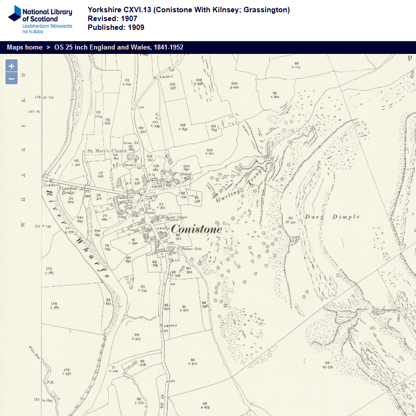
You are here: Home>View the Catalogue>Upper Wharfedale Arts & Literature Society>Conistone with Kilnsey>Local History and People>Ordnance Survey Map - Yorkshire CXVI 13. (Conistone with Kilnsey; Grassington) From: Up Prev Next Ordnance Survey Map - Yorkshire CXVI 13. (Conistone with Kilnsey; Grassington) Map revised in 1907 and published in 1909, extract from the National Library of Scotland From: Upper Wharfedale Arts & Literature Socie... Creator Ordnance Survey Date of creation 1909 Contributor UWALS Reference number UWA/004/002/007 Subjects Buildings, Dwellings and Infrastructure (1259)Landscape (382) Places Conistone (25) Formats Map (83) No Comments Start the ball rolling by posting a comment on this page! Add a comment about this page Your email address will not be published. Required fields are marked *Your comment:Name * Email * Website Save my name, email, and website in this browser for the next time I comment. I consent to my name and e-mail address being stored along with this comment, and to the website editors communicating with me by e-mail about the comment if necessary. My name may be published alongside the comment on the website, but my e-mail address will not be published. My information will not be shared with any third party (see our Privacy Statement - opens in a new window). * Δ Search the archive Advanced By subject By place By format By date
 - Ordnance Survey 25 inch England and Wa[...]")
No Comments
Add a comment about this page